Utah, You Bet.
After what was a great stay in a fantastic region we hit the road again. This time we’re heading for Moab in South Eastern Utah. I have started the gallery with a map because it gives a good indication of the differing territory we had to cross over the 2 days travel. The first day we wound our way north through a long valley to our overnight stop, Richfield. For much of the way we were following a river through the valley but for the most of the trip it was uneventful.
Up and Down, Round and Round.
Day 2 and we turned East on Interstate 70 to Moab. We had no idea what to expect. Being on the bottom of the Rockies we did think “hills and valleys” but no way did we expect what we found. The first third of the trip was as expected but magnified. We knew it was cold as the night before at Richfield we could see snow on the mountain tops either side of us but on this leg we climbed the mountain passes up into that dreaded white stuff. The final third was pretty uneventful as well having climbed down to the lower plateaux at around 5000 feet.
Rock Heaven
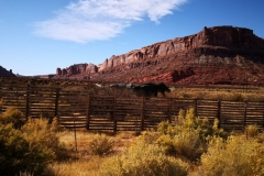
It was the middle third that blew us away. To use the phrase on the sign “The San Rafael Swell” (see the photo) we “have driven into a geologist’s paradise”. You should read the two signs I have posted. This really was a strange landscape. The shapes, colours and variances are mind boggling and to me with my environmental degree behind me I wanted to pitch tent here and explore. The signs you see are on top of a lookout in Castle Valley. We were walking on huge flat, round edged sandstone ‘platforms’. From the edge we overlooked multicoloured sands and weird rock formations. To the side of the cliffs was flaky sandstone chips covered in shrubby, wind twisted conifers. Below in front of us we could see deep eroded gullies with much rilling in the brown soil. Further out were lighter yellow desert like areas and beyond that the darker schists of metamorphic shales.
The San Rafael Swell.
After checking out the Navajo crafts and jewellery for sale at the first lookout we continued East for another hour or so. On the way we stopped at various scenic views. I have included a photo that might interest gardeners and that is of the desert groundcover plant. We almost missed it because it is so tiny and coloured like the gravel it sits in. Also look at the way the trunk of that conifer is so twisted in this open windy location. Moving along there were so many outstanding features there is no way we could post them all here. We came to the edge of the plateau dropping down to Green River. However it was no gradual drop.
Coming Off the Plateau
We reached Spotted Wolf Canyon with a mixture of feelings. Glad we were about to descend from the windy top of the plateau but sorry to see the end of this Geologist’s Paradise. The view from the canyon top looking over the I-70 to Green River was awesome and scary at the same time. Because the roadway is going away from the camera it belies the actual steep grade of the highway but it was another case of satisfaction that we keep the car in good condition and had the brakes replaced back at Flagstaff. This was never so true as when we passed the wreck of a semi that had burnt out probably due to overheating brakes. It was great to make Moab soon after and get set up and have a relaxing beer (or two). If you click here there is a video of this middle third with some stunning scenery.
Moab Town
We got to the RV Park which is about 10 miles north of Moab and dusty. The thing we’ve noticed on this side of the Grand Canyon is that so many people tow ATV/buggies behind their rigs (even behind 5th wheelers like a B-Double). This park is full of them but after a few days of looking about (which I’ll get to in the next blog) I can understand why. For now though I’ll stick with the description of the road to Moab. Once on the highway we travelled through a high sided canyon with some fantastic geological forms. In this canyon there’s a ‘bay sand dune’ where some kids were having a ball. This sand dune is directly opposite the entry to Arches National Park. As you get through the canyon you cross the Colorado River and then enter the busy tourist town. Oh yeah. Just opposite our RV Park is a Dinosaur exhibit with life size replicas you can wander amongst.
A Secret Canyon
When we left the Moab CBD after shopping we noticed a sign to Potash Rd. A quick glance at the map and there was a tiny dot on the map that said “Petroglyphs” and that is all we needed to know. We took the road and what a surprise package we found. Yet another dramatic steep canyon which the Colorado River was flowing through. Just a mile in and the side of the road was crowded with people rappelling up the side of the sheer sandstone walls. On the other side of the road was the river bank. Another mile or so further up the canyon we sighted the first of many petroglyphs left by the local Navajo. I’ll put the rock art in a separate gallery for you to peruse.
More Arches and Scenic Cliffs
Besides the glorious landscape there are two items worth noting in this gallery. Towards the end of the gallery there’s a pair of signs. They show Potash Rd and in particular the winding, climb at the end in Canyonlands National Park. Remember this for my next post which will show you something we didn’t think possible after Bryce & Zion NP. Arches, Dead Horse and Canyonlands are extraordinary in their wonderful vistas and natural beauty. The second noteworthy photos are the two rock arches visible from this road. The arches are the highest prominent feature of this region centred around Arches National Park. I’ll show you Arches, Dead Horse & Canyonlands in my next blog.
no images were found
Petroglyphs and Dinosaur Tracks
Petroglyphs are pictures chipped or scratched into the rock face. These can have many meanings from signposts to warnings to ceremonial or just plain art. Along Potash Road we found hundreds of these petroglyphs. Most were only around 4 – 5 metres above the road but some I had to climb up a scree slope of large boulders to get to. The bonus for my climb though was to get up close to some dinosaur tracks in the rubble. Potash Road really turned out to be a secret treasure trove.
no images were found
That’s it for now. Time to post this blog.Cheers
Garry and Shane


